


3°C
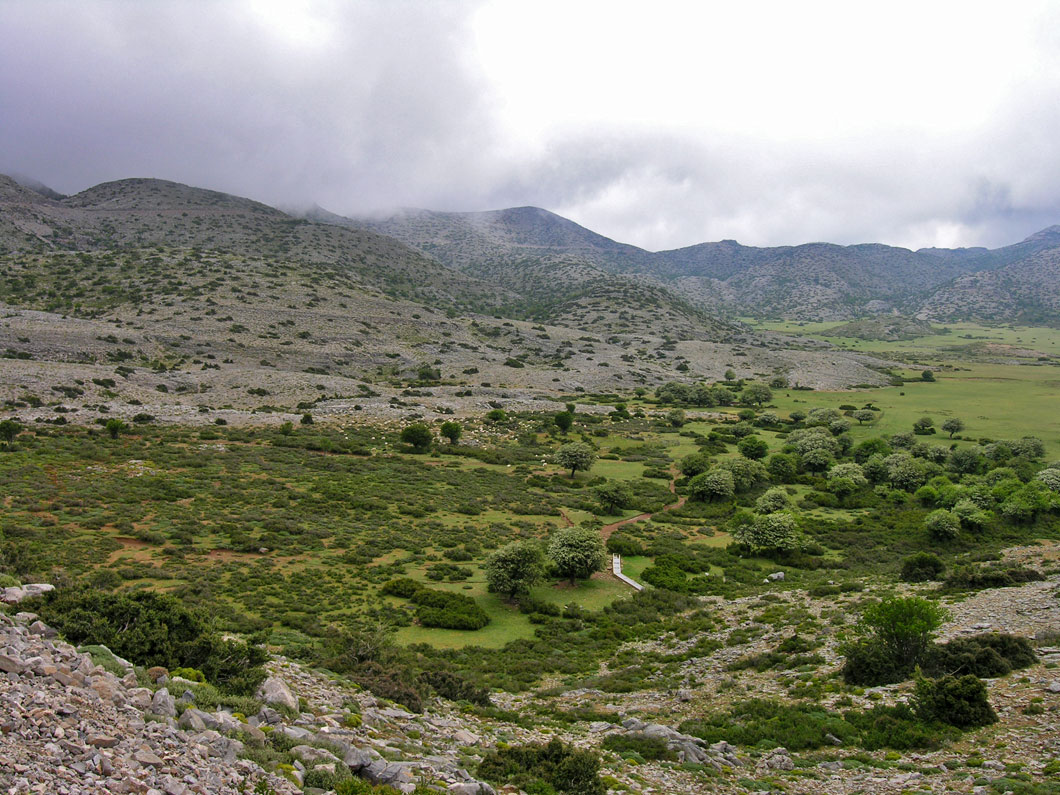
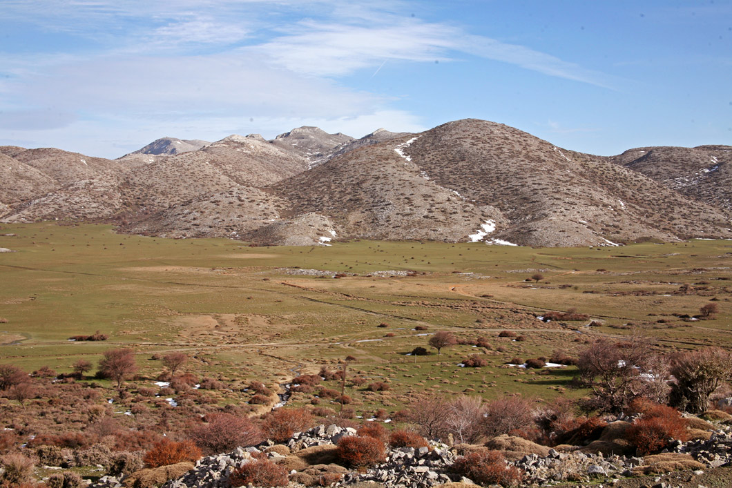
Nida Plateau lies at the heart of the Psiloritis or Ida range. Its name comes from a contraction of the words “στην Ιδα” (stiN Ida).
In shape it is roughly triangular, with its shortest side at the south, the so-called Passage of Milias, through which the southern foothills towards the Mesara can be accessed. East of the plain is the peak of Skinakas: here at a height of 1750 m is the only Astronomical Observatory on Crete.
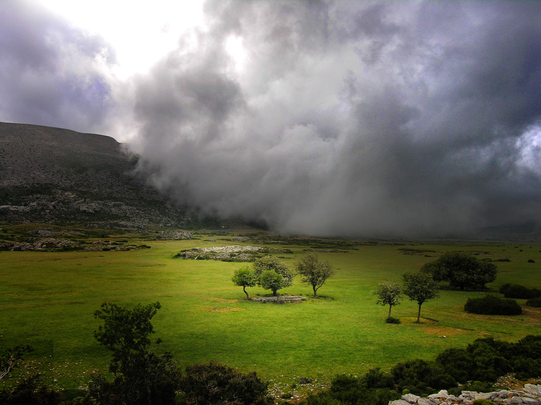
The plain is quite flat, and covered by a weed – nevrida or chrysochorto to the locals (it gradually turns the teeth of the sheep golden!).
The Nida region in earlier times, before the rise of organized farming and the logging of its fir trees had drastically reduced its flora, had been heavily wooded.
Here according to mythology and traditional tales various things happened: the Goddess Demeter fell in love with the mortal Iasion; and the Renaissance hero Charidemos chased and caught his beloved hereabouts. In more recent history, the locals from the region took refuge on Nida in the many uprisings; in the German Occupation it was a centre of resistance.
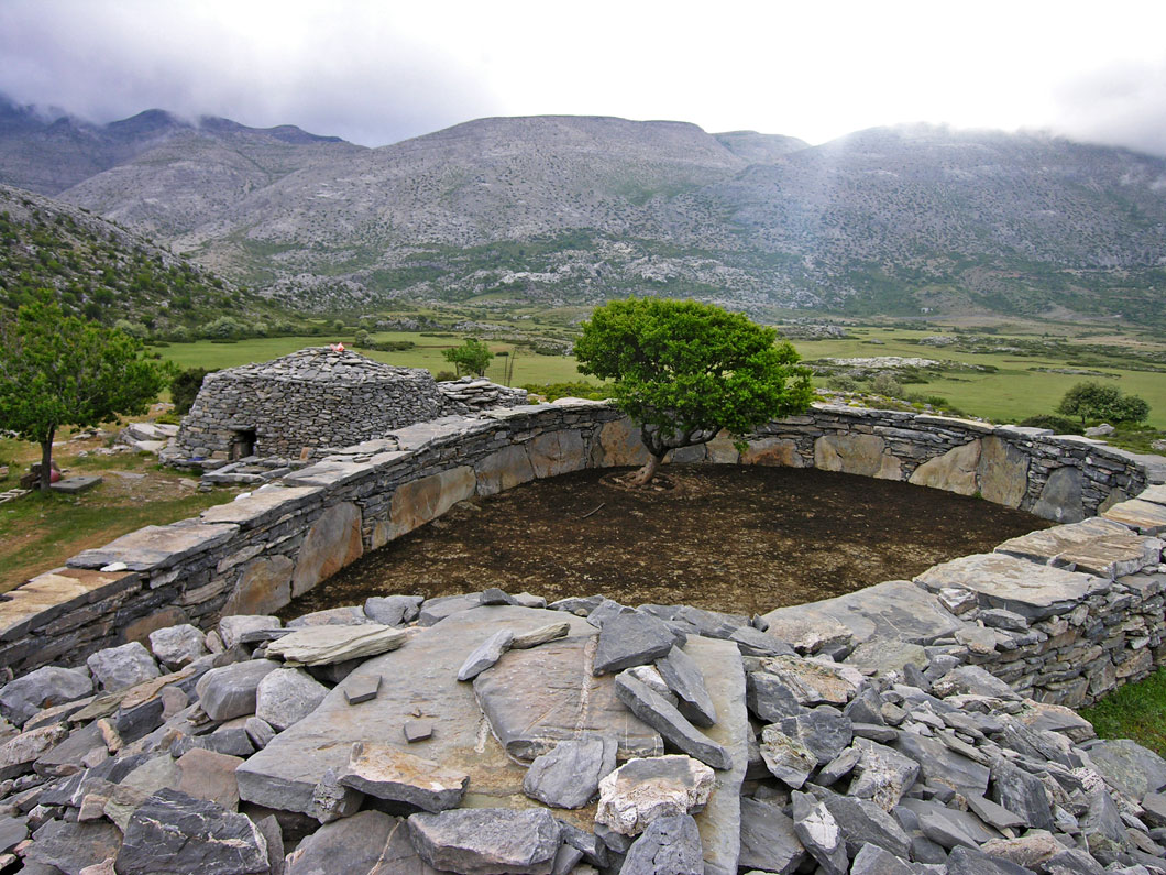
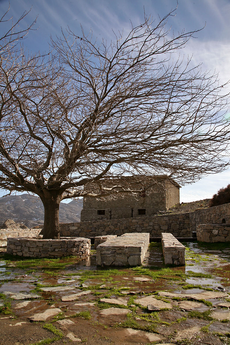
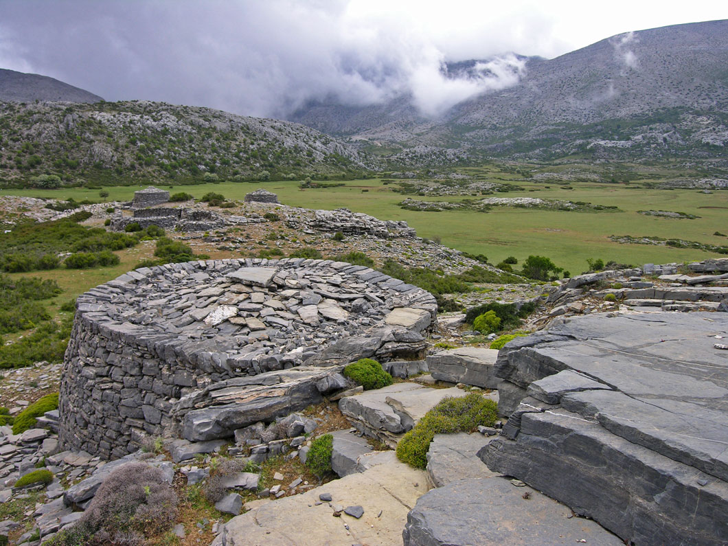
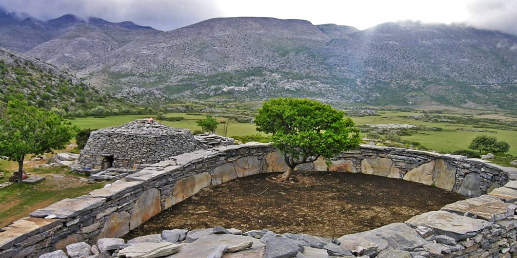
Today Nida is a rich ranching area: the dry-stone mitata, that structure so emblematic of the plain, are scattered across it.
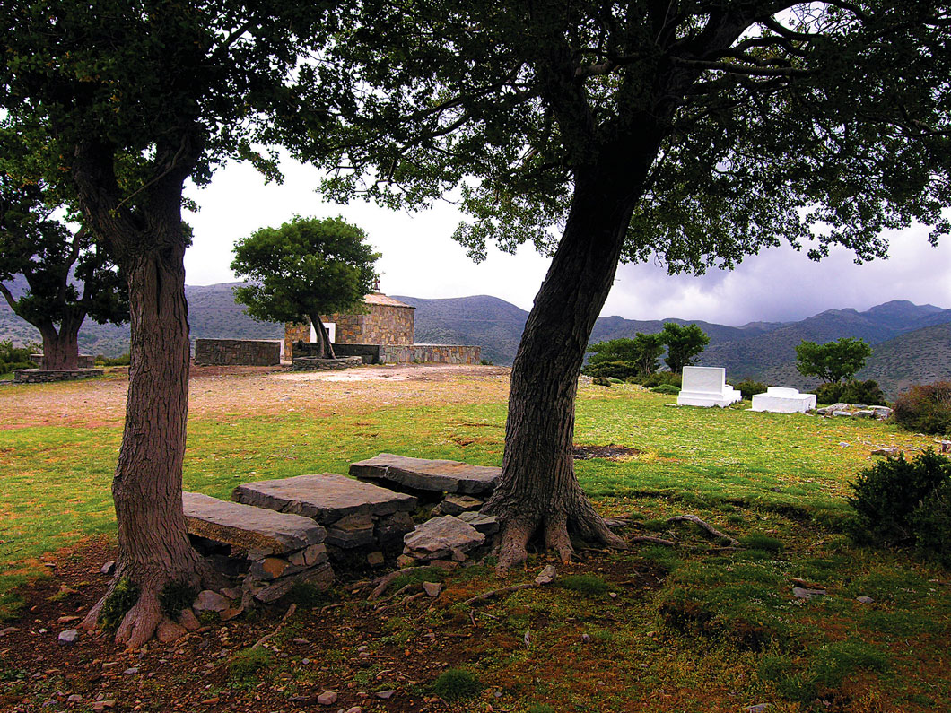
Recent and determined efforts have been made to develop alternative forms of tourism here: the mitata have been repaired, the archaeological site of the Idaean cave and the Ascension church have been planted about with trees and the infrastructure for visitors to stay has been put in place with regard to the ecological centre and athletic activities.
Anogeia belongs to the region: it lies 22 km off.
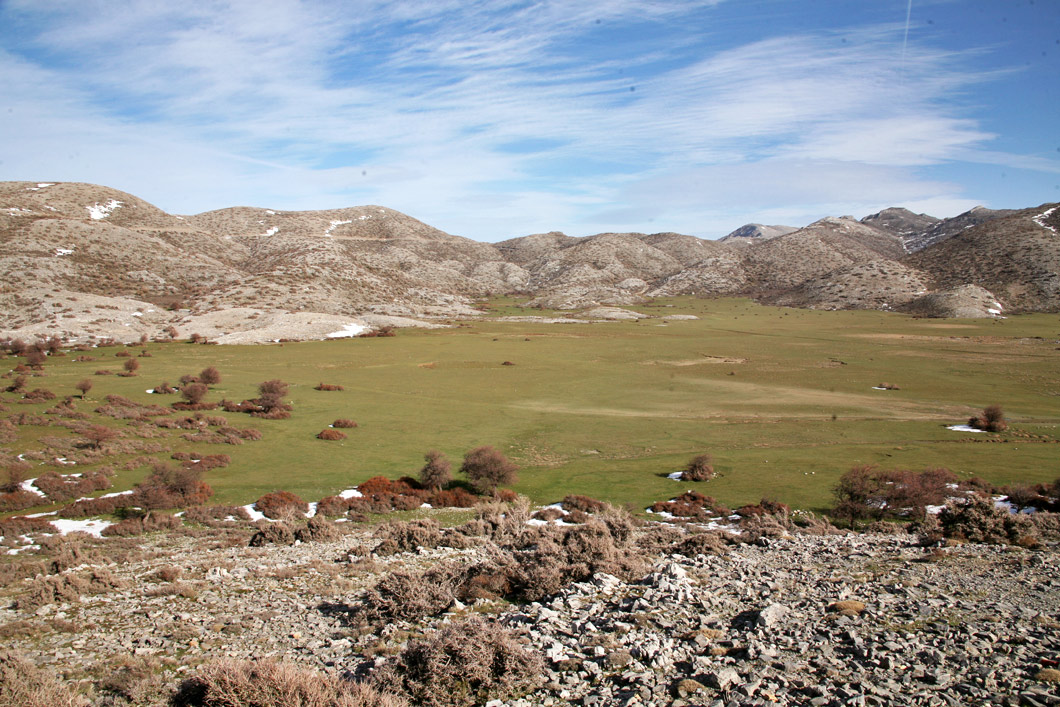
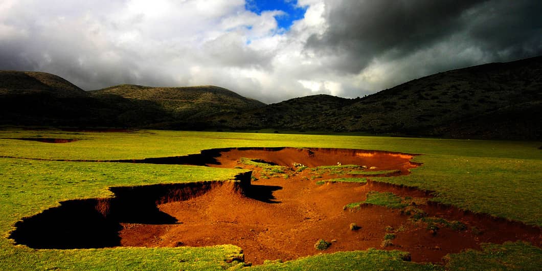
The Nida Plateau is the highest plateau in Crete, with an average altitude of 1360 meters. Essentially, it is a polje formed due to karstic dissolution and the merging of neighboring, smaller depressions. Like the neighboring plateaus in Petradolakia, the Nida Plateau is formed at the contact of the two major carbonate units, the platy limestones, and the Tripolis formation. However, the large fault of Ideon delineating the eastern slopes of Psiloritis and the plateau simultaneously played a significant role in its formation.
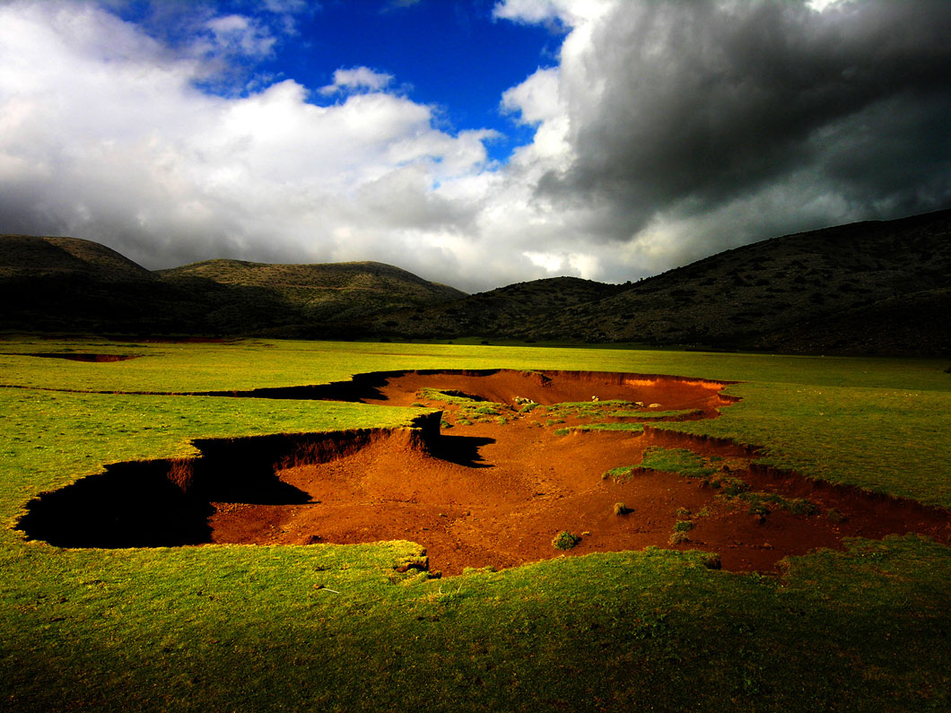
The fault submerged the area of the plateau relative to Psiloritis, creating conditions for the accumulation of more water and greater dissolution of rocks. Interestingly, the entrance to the Ideon Cave is located precisely on the fault, which is the reason for its exposure. Additionally, many sinkholes, from which water disappears into the ground, exist in the northern part of the plateau, which appears to have subsided more. A characteristic feature of the plateau is the countless “Mitatá,” the dry stone constructions of shepherds.
The geosite description is a result of the deliverable of the research project Joint Innovative Activities for Outdoor Tourism-JoinOut. The project entitled “Partnership of Innovative Rural Tourism Actions” and distinctive title: “JoInOuT”, is implemented within the framework of the Action “Cooperative Innovation Formations/SCC” – 2nd Call: Businesses” and is financed by the European Regional Development Fund (ERDF) and by National Resources in the context of the Operational Program “Competitiveness, Entrepreneurship and Innovation (EPANEK)” of the NSRF 2014-2020″ (Project code: ΓΓ2CL-0359457).